Trail Walking La Chapelle-en-Vercors - Boucle de 3 jours dans le Vercors - Photo

Boucle de 3 jours dans le Vercors

 tracegps
tracegps

User

© OpenStreetMap contributors
Length
Length
56 km
Max alt
Max alt
1619 m
Uphill gradient
Uphill gradient
1936 m
Km-Effort
Km-Effort  
82 km
Min alt
Min alt
825 m
Downhill gradient
Downhill gradient
1935 m
Boucle
Boucle
Yes
Creation date :
2014-12-10 00:00:00.0
Updated on :
2014-12-10 00:00:00.0

(0 Reviews)

Walking
Walking
0h00
Difficulty : Difficult

Scan this QR Code to open this trail in the SityTrail application

FREE GPS app for hiking

Logo SityTrail SityTrail

IGN / Geographical institutes

Download SityTrail from the App Store Download SityTrail from Google Play

Logo SityTrail SityTrail World

The world is yours!

Download SityTrail from the App Store Download SityTrail from Google Play Download SityTrail on Huawei AppGallery

About

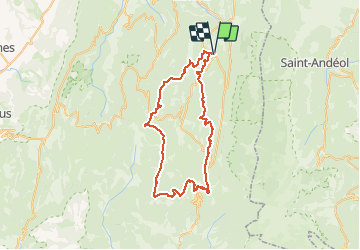
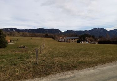
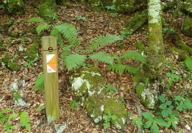
Trail Walking of 56 km to be discovered at Auvergne-Rhône-Alpes, Drôme, La Chapelle-en-Vercors. This trail is proposed by tracegps.

Description

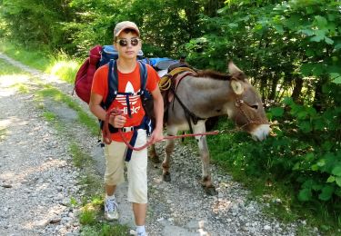
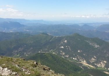
Une boucle dans le Vercors en trois jours à raison d'environ 8 h de marche par jour. La deuxième journée entre le Col de Rousset et Font d'Urles est très belle car une grande partie du parcours se fait sur les crêtes.

Elevation profile

Photos

Positioning

Country:
France
Region :
Auvergne-Rhône-Alpes
Department/Province :
Drôme
Municipality :
La Chapelle-en-Vercors
Location:
Unknown
Start:(Dec)
Start:(UTM)
690377 ; 4982220 (31T) N.

Trails nearby

Trail Walking La Chapelle-en-Vercors - Belvedere de la Révoulat - Photo
Walking
simon.paume

Walking

Easy
(1)
La Chapelle-en-Vercors, Auvergne-Rhône-Alpes, Drôme, France
5.3 km | 10.6 km-effort
2h 5min
Yes
Trail Walking Saint-Laurent-en-Royans - 26 rocher des mines ARP - Photo
Walking
himba26100

Walking

Very difficult
Saint-Laurent-en-Royans, Auvergne-Rhône-Alpes, Drôme, France
8.6 km | 16.2 km-effort
6h 53min
Yes
Trail Snowshoes La Chapelle-en-Vercors - 26 raq claveyron - Photo
Snowshoes
himba26100

Snowshoes

Medium
La Chapelle-en-Vercors, Auvergne-Rhône-Alpes, Drôme, France
15.2 km | 23 km-effort
7h 51min
Yes
Trail Walking Saint-Agnan-en-Vercors - 26 st Agnan champ gros de la vache - Photo
Walking
himba26100

Walking

Medium
Saint-Agnan-en-Vercors, Auvergne-Rhône-Alpes, Drôme, France
16.9 km | 27 km-effort
6h 51min
Yes
Trail Walking La Chapelle-en-Vercors - La Chapelle en Vercors - Vassieux (Première étape balade ânes) - Photo
Walking
crocau

Walking

Easy
La Chapelle-en-Vercors, Auvergne-Rhône-Alpes, Drôme, France
11.3 km | 15.1 km-effort
3h 53min
No
Trail Walking La Chapelle-en-Vercors - Le tour de la Chapelle en Vercors - Photo
Walking
crocau

Walking

Very easy
(1)
La Chapelle-en-Vercors, Auvergne-Rhône-Alpes, Drôme, France
8.7 km | 10.9 km-effort
2h 43min
Yes
Trail Walking Saint-Martin-en-Vercors - orientation Roybon - Photo
Walking
JARJATTE

Walking

Very easy
Saint-Martin-en-Vercors, Auvergne-Rhône-Alpes, Drôme, France
3.2 km | 4.1 km-effort
2h 53min
No
Trail Walking Saint-Martin-en-Vercors - F26 ST LCV Tourtre la Sambue N2 - Photo
Walking
ageo

Walking

Medium
(1)
Saint-Martin-en-Vercors, Auvergne-Rhône-Alpes, Drôme, France
15.7 km | 28 km-effort
5h 50min
Yes
Trail Walking La Chapelle-en-Vercors - tour du Vercors en 3 jours - Photo
Walking
fashiondapulse

Walking

Difficult
La Chapelle-en-Vercors, Auvergne-Rhône-Alpes, Drôme, France
60 km | 88 km-effort
15h 5min
Yes


Close
My subscriptions